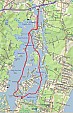
1-overview_map
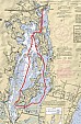
2-marine
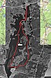
3-aerial
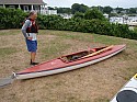
P7300130

P7300131
P7300132
P7300133
P7300134

P7300135
P7300136
P7300137
P7300138

P7300139
P7300140
P7300141
P7300142
P7300143
P7300144
P7300145
P7300146
P7300147
P7300148

P7300150
P7300151
P7300152
P7300153