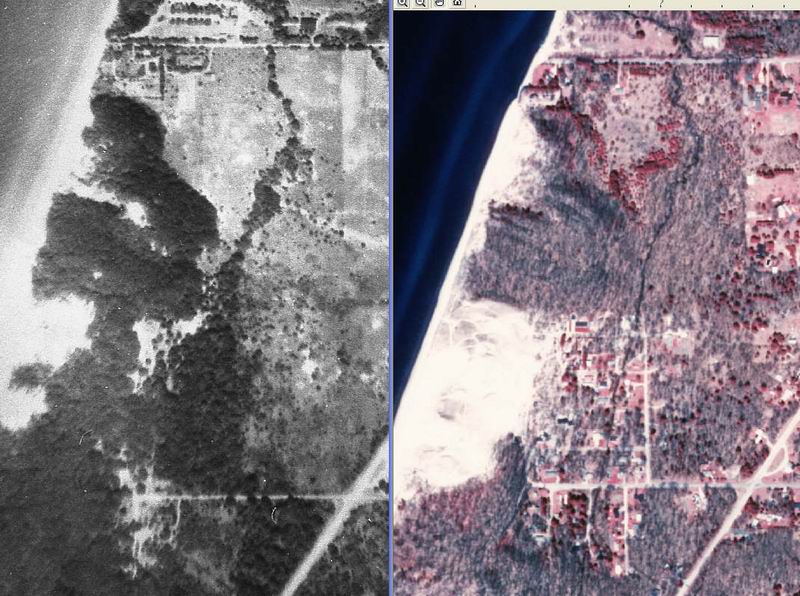
These two adjacent images are, on the left the b/w from the pre-1950 camp photo, and on the right the IR image
which is more current. The first most obvious thing is the change in the dunes to the south. The dunes appeared
to be quite destroyed, but I have no knowledge of how high they are now. The next feature to look at is the
camp itself and see how much has been lost to shoreline erosion. It is easier to look at the house's driveways across from
the camp grounds to see the land lost. When I was at camp, there was a house right on the edge of the bluff on the south
side of the road. It probably did not last another 5 years be fore it dropped off the edge. I would say that at least 150 feet
has been lost. Greater than the length of the Meeting House.