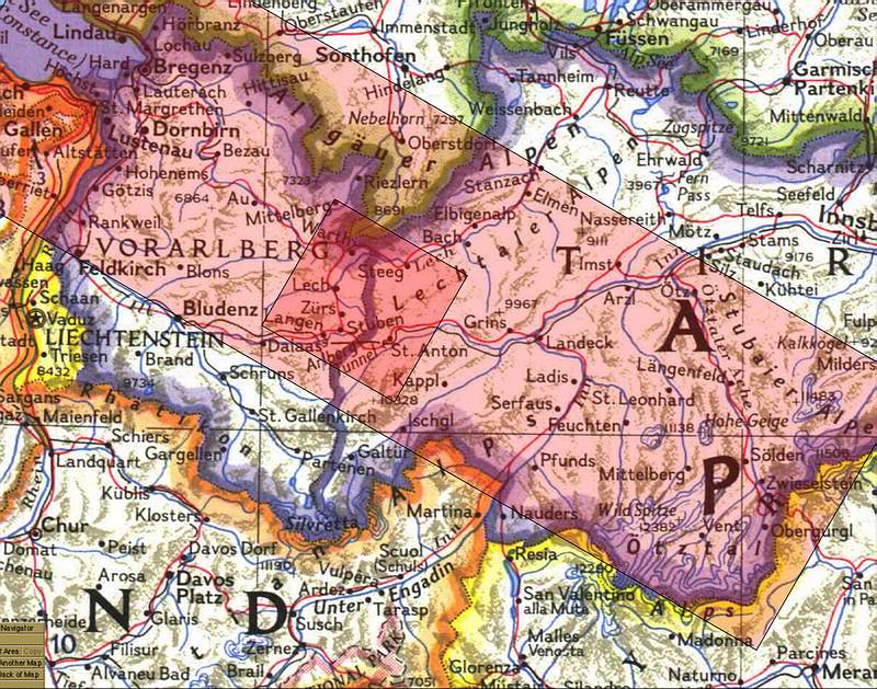
Location of Krabach Valley and Peak in Western Austria
The above portion of western Austria was covered by a X-SAR (Synthetic Apature Radar) satellite overpass. One frame of the scanned area is indicated by the red shaded area above. The satellite passed from the upper left to the lower right. Click anywhere on the red and link to the X-SAR satellite frame. The darker red shaded area will show an enlarged detail section where the Krabach Valley and Peak are located..
Note that in the above map North is up, but on the linked maps the view will be toward the Southwest from the top of this map. In this map Switzerland is to the left and lower left, Italy to the lower right, Germany is above and the rest of Austia is to the right. The Arlberg Tunnel is in the major east-west valley in the lower part of the smaller detail map. Map detail from National Geographics Maps. (1985)